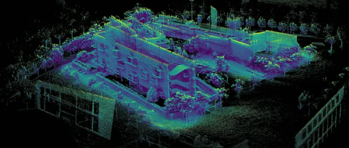
What is SLAM Technology?
SLAM refers to the process of creating a 3D map by fusing data from multiple sensors such as Lidar, cameras, and IMU (Inertial Measurement Unit). It is a crucial component in many fields including robotics, autonomous vehicles, and computer vision.
The short history of SLAM dates back to the late 1980s when GPS systems became commercially viable. Since then, Lidar technology has been integrated into these systems to improve their accuracy. Research and development have rapidly advanced since then, creating various types of SLAM systems.
There are two main types of SLAM: Visual SLAM and Lidar SLAM.
Visual SLAM: This type of SLAM uses camera data to create a 3D map. It is commonly used in computer vision applications.
Lidar SLAM: As the name suggests, this type of SLAM uses Lidar data to create a 3D map. It is ideal for creating highly accurate maps in outdoor environments.


